
ROANOKE, Va. – Wednesday starts off cool once again with more clouds east and more clear sky west. We eventually all break out into a mostly sunny-to-partly cloudy sky throughout the day.
Temperatures rise into the 70s in the mountains and lower 80s elsewhere, which is pretty much on par with what to expect in mid-to-late September.

Come Friday, we’ll see an increase in clouds and highs around 70 to 76°. This sets us up for high school football, which may feature some drizzle and mist east of the Parkway during the game.
This comes as high pressure starts to wedge cooler air at the surface and moisture overruns that.
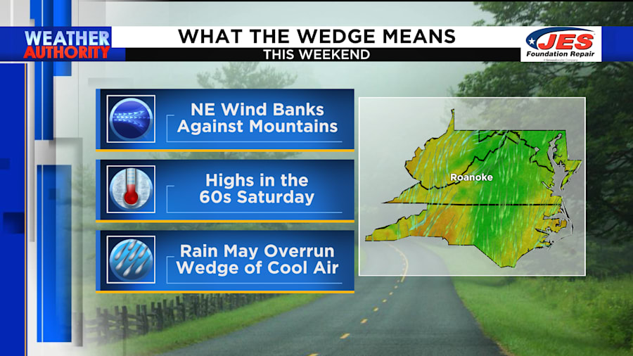
Rain becomes likely at times - especially Saturday morning. A storm system riding along the coast will bring more rain there and lighter totals here.
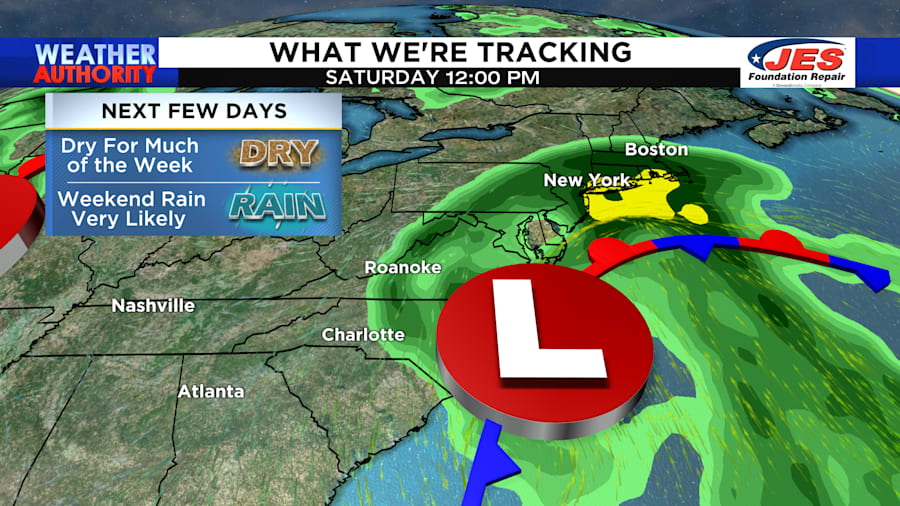
For the weekend, your outdoor plans may be limited Saturday. It looks like we won’t be as wet Sunday as our coastal storm system pulls away.


